The Adventure of the Burning Hay Carts
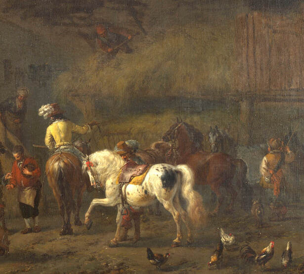
Phillips Wouwerman, 'The Interior of a Stable' (detail) National Gallery
English Civil War strongholds were typically taken by siege or storm, but in July 1644 Lord Grey had other plans – all he needed to capture a royalist garrison on the river Trent was several cartloads of hay and a lighted match.
The royalist garrison near Great Wilne, Derbyshire, was established in the winter of 1643. Its purpose was to maintain a direct line of communication between Lord Hastings' Leicestershire royalists and the Earl of Newcastle's forces, who at that time were advancing into Derbyshire from the north. It also aimed to disrupt traffic crossing the Trent, particularly the lead trade in which the foremost Derbyshire parliamentarian, Sir John Gell, had a considerable interest.
The destruction of the Earl of Newcastle's army at the battle of Marston Moor on 2 July 1644 left Derbyshire royalists in a vulnerable position, and Gell and Lord Grey sought to further isolate them by severing their passage across the Trent. Hastings was in no position to retaliate as much of his own force had been sent into the north to support Newcastle and had yet to return.
Gell, in his personal account of the war, described the royalist position at Wilne Ferry as “a strong fort”, although he appears to have exaggerated the garrison strength. Contemporary reports suggest that the fort consisted of earth works and ditches, with two light field guns to guard the approaches. Passage across the river was provided by a rope-hauled ferry boat. The garrison's commander was Captain Robinson of Hastings' regiment. There were two other captains in the garrison, which could indicate three companies, although the garrison's total strength was about 70 men.
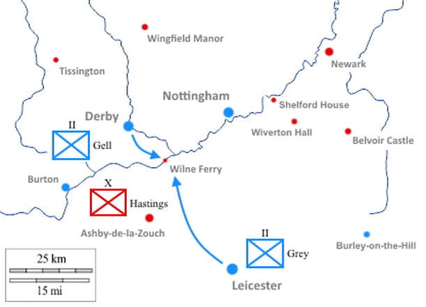
The Trent Valley, July 1644, showing royalist (red) and parliamentary (blue) garrisons. Grey and Gell aimed to cut the line of communication between Leicestershire and Derbyshire royalists by taking Wilne Ferry.
Lord Grey's Leicestershire parliamentarians rendezvoused with Gell on the banks of the Trent and, Gell recorded, “soe immediately environed the ffort and planted there ordinance, and the next day made ready to storme it”. The unorthodox manner of the attack is recorded in John Rushworth's Historical Collections, dated 17 July 1644:
...they got about sixty Cartload of Hay, and other Combustible Stuff, which they drove up to the Works of the Garrison, and brought up their Souldiers behind them in security. Then they set the Hay on Fire, the Smoke whereof being driven by an high Wind, fell upon the Garrison, so grievously annoy'd them within that they were soon driven from their Works.
Another account of the action, recorded by Bulstrode Whitelocke, is similar to Rushworth's but not identical. Whitelocke read or heard report that once the fort's outlying defences had been cleared “their trenches [were] filled with the hay and other stuff” to prepare they way for an assault. Captain Robinson had initially offered to surrender on the guarantee that would be allowed “to march away with bag and baggage”. This had been refused. Now that an assault was imminent, Robinson surrendered unconditionally. Whitelocke recorded one royalist soldier killed and 70 taken prisoner.
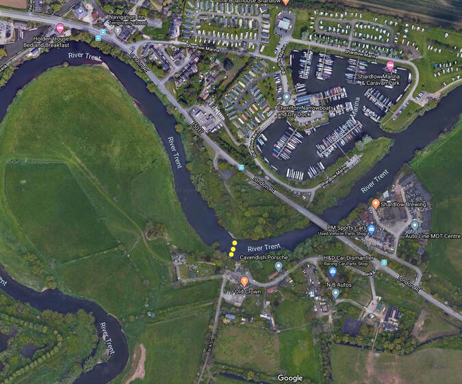
The area on the Leicestershire/Derbyshire boundary now known as Cavendish Bridge. The Royalist fort stood on the south side of the Trent. Marked in yellow is the probable site of the 17th century ferry.
The Site Today
Sources agree that the royalist fortification was demolished following its surrender, and it is impossible to distinguish any traces of it from the ditches and embankments that form the area's later flood defences. The 19th century topographer Daniel Lysons tells us that the fort stood on the Leicestershire side of the river, though he is in error as placing the attack in April 1643.
In the 1600s the river was crossed by ferry but in the following century a stone bridge was built by the Cavendish family, which gave Wilne Ferry its modern name – Cavendish Bridge. The stone bridge was destroyed by floods in the 1940s and was replaced by the modernt road bridge in the 1950s.
Robert Hodkinson
July 2020
Robert Hodkinson
July 2020
Sources:
Gell, Sir J. 'A True Relation', in: Noble, T. (ed.) The History, Gazeteer and Directory of the County of Derby (Derby, 1829), p.67
Lysons, D. and Lysons, S. Magna Britannia, vol. 5 (London, 1817) pp. 3-23. British History Online [viewed 9 July 2020] http://www.british-history.ac.uk/magna-britannia/vol5/pp3-23
Polkey, A. 'Civil War Derbyshire: Sir John Gell's “True Relation” reconsidered', in: Derbyshire Miscellany, 14, 6 (Autumn 1997), pp.151-176
Rushworth, J. 'The Civil Transactions of the Year 1644', in: Historical Collections of Private Passages of State, vol. 5 (London, 1721) pp. 748-787. British History Online [viewed 9 July 2020] available: http://www.british-history.ac.uk/rushworth-papers/vol5/pp748-787
'Shardlow History', Triposo Travel Guide [viewed 9 July 2020] available: https://www.triposo.com/loc/Shardlow/history/background
Whitelock, B. The Memorials of the English Affairs, vol. 1 (Oxford, 1853), p.282
'OS Map name 005/SW', in Map of Leicestershire (Southampton, 1884-1892), British History Online [viewed 9 July 2020] available: http://www.british-history.ac.uk/os-1-to-10560/leicestershire/005/sw
